تصاویر برنامه


معرفی برنامه
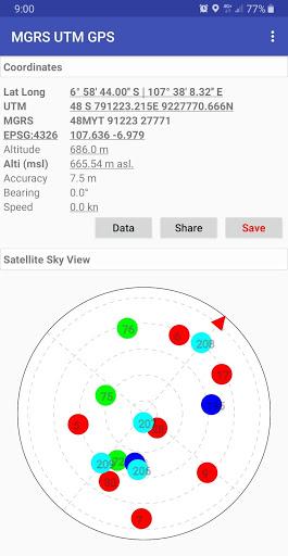
Simple scientific offline GPS application with Latitude Longitude, UTM, MGRS and other Coordinate Reference System in the World (using EPSG Codes, You can find the codes for most commonly used map projections at https://www.spatialreference.org).
Additional information include GPS altitude (Ellipsoid), MSL altitude (EGM96), accuracy, speed, bearing and GPS Sky View complete with information about satellite name, satellite location (azimuth & elevation angle) etc..
Free Features:
- Getting GPS coordinates from most commonly used map projections / Coordinate Reference System in the World.
- Share or save unlimited measure data inside your database.
- Change altitude units (meter, feet).
- Change Latitude Longitude display format (decimal degrees, DMS)
- Change UTM display format (UTM with band letter, UTM with north/south hemisphere)
- Change speed units (m/sec, km/h, mi/h, knots)
- Add photo to your data.
- Labelling: edit notes / label on each observation data.
Premium Features:
- Export data to CSV, KML, GPX and DXF file.
- No Ads.


برنامههای مرتبط
دیگران نصب کردهاند


برنامههای مشابه


