| نصب | ۶۱ هزار |
| از ۶۶ رأی | ۴.۳ |
| دستهبندی | ابزارها |
| حجم | ۲۱ مگابایت |
| آخرین بروزرسانی | ۱۴ تیر ۱۴۰۴ |

| نصب | ۶۱ هزار |
| از ۶۶ رأی | ۴.۳ |
| دستهبندی | ابزارها |
| حجم | ۲۱ مگابایت |
| آخرین بروزرسانی | ۱۴ تیر ۱۴۰۴ |
تصاویر برنامه


معرفی برنامه
Satfinder Finder Inclinometer with Digital Gyro compass and bubble level meter. Ever wanted to observe the International Space Station crossing your sky or find out where the ISS and other man-made satellites are right now? With Satellite Tracker app you can easily find out where any satellite can be seen from different locations in the world and get pass predictions for their passes. This app was made specifically for easy and comfortable real-time satellite tracking.From the developers of the famous astronomical app Star Walk, winner of the Apple Design Award 2010, loved by more than 10 million users around the world.This new Satellite Tracker app stands out among other satellite applications with its stunning visuals, attractive and easy-to-use interface. SatFinder Lite, an Android satellite finder. The Lite version is slimmed down version of the full SatFinder, which has additional functionality such as Target Satellite view and no ads.
SatFinder is a tool for finding TV satellites and aligning satellite dishes. Use your Augmented Reality Camera view to see and target satellites in the sky. It can be used anywhere in the world since all major TV satellites are in the database.
*New feature: New fetcher is adding the digital Gyro compass to see your right way where you want to go.
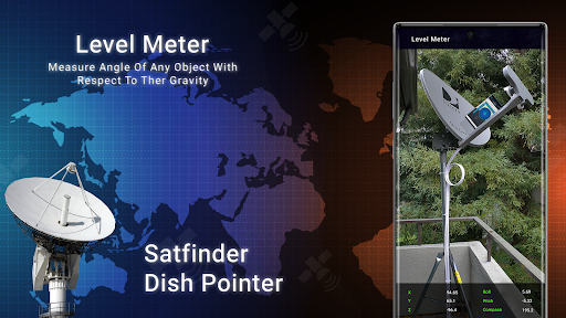
Bubble Level - Inclinometer
Best Level functioning as a real physical equivalent (also known as libella, the spirit level or bubble level). You can easily check if the measured surface is truly flat. An inclinometer or clinometers is an instrument for measuring angles of slope (or tilt), elevation or inclination of an object with respect to gravity. It is also known as gradient meter, gradiometer, level gauge, level meter, declinometer, and pitch & roll indicator.
Features of Satfinder (Dish Pointer) Area Calculator:
- Satellite view above your location where to point the dish
- More Than 150 Satellites available worldwide
- vibrate on finding exact direction
- Display your location and all satellites the values for: azimuth, elevation
- Accuracy of measurement with Bubble Level
- 3 different display modes or Level Meter
- Spirit level, bubble level, electronic level, laser level, plumb bob, level tool, clinometer, leveler, protractor, inclinometer, carpenter's level
- Land Based Surveys - This satfinder also provide you toGyro compass in this application.
SatFinder uses your phone sensors to detect your physical location and calculates the azimuth and elevation needed for your satellite antenna to face. Since the satellite position calculation depends on the accuracy of your device sensors, your device should be calibrated by shaking and moving it in a figure 8 fashion, once SatFinder has been started.


برنامههای مرتبط
دیگران نصب کردهاند


برنامههای مشابه


